 English (UK)
 English (US)
 Français
 Deutsch
 Español
 Italiano
 Nederlands
 简体中文
Mixed: depends where you go Our reading of the sources below, not an official rating.
We hold no sourced driving notes for the Peak District beyond the general rules in the driving guide.
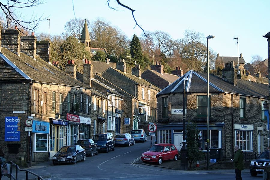

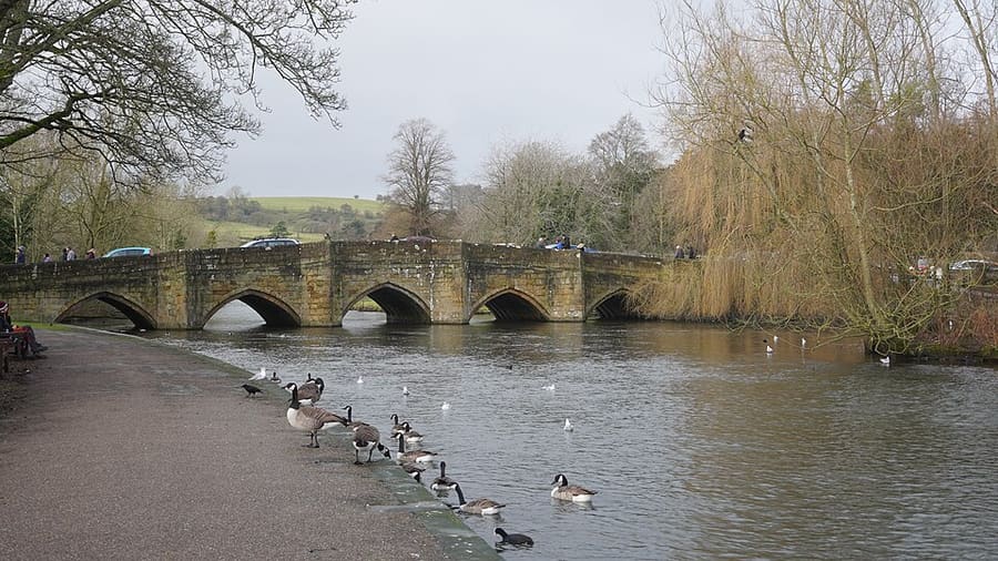

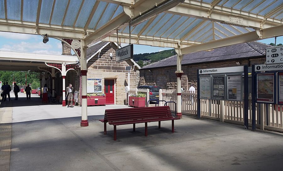

Stations, bridges and harbours from our guide where we hold a photo; each links to the area page that lists it.
Paying for local transport in the Peak District
Regional buses and trains
- Visit Peak District & Derbyshire says the area is easy to reach by rail and bus and recommends public transport for car-free days out, but the page we read names no tickets or fares. The National Park Authority’s travel page did not respond to our fetch tool, so check it and Derbyshire County Council’s Wayfarer ticket page directly.Source: Visit Peak District & Derbyshire (opens in new tab), Peak District National Park Authority (site not readable to us), Derbyshire County Council (opens in new tab), checked 1 Nov 2026.
Without a car
Getting here
By train
Visit Peak District says trains from London St Pancras International reach Derby in less than 2 hours, then run on to Chesterfield and Sheffield, while trains from London Euston run to Stoke-on-Trent, Macclesfield, Stockport and Manchester Piccadilly. Northern runs the Hope Valley line from Manchester to Sheffield, calling at Grindleford, Hathersage, Bamford, Hope and Edale, and lines to Buxton and Glossop. East Midlands Railway runs the Derwent Valley Line to Matlock, serving Cromford. Northern gives an average of 43 minutes from Manchester Piccadilly to Edale and 1 hour 1 minute to Buxton. 1
Visit Peak District: travelling by train (opens in new tab) · Northern: the Peak District (opens in new tab) · National Rail (opens in new tab) · Manchester guide (opens in new tab)
By bus
Visit Peak District lists the Stagecoach Gold X17 from Sheffield and Chesterfield to Matlock Bath, Cromford and Wirksworth, Trentbarton's 6.1 from Belper to Wirksworth, Matlock Bath, Matlock and Bakewell, and High Peak routes from Buxton (61, the 62 Peak Pathfinder and the 442 to Ashbourne). A summer Peak Sightseer open-top bus calls at Castleton, Chatsworth, Bakewell, Bamford, Padley Gorge, Hathersage and the Monsal Trail. Buses from the stations at Buxton and Matlock continue to Bakewell and White Peak villages. 2
Visit Peak District: travelling by bus (opens in new tab) · Stagecoach X17 (opens in new tab) · Peak Sightseer (opens in new tab) · Trentbarton SIXES (opens in new tab) · Travel Derbyshire timetables (opens in new tab) · Traveline (opens in new tab)
Once you are there
Hop-on buses in summer
The Peak Sightseer open-top bus links Castleton, Chatsworth, Bakewell, Bamford, Padley Gorge, Hathersage and the Monsal Trail, and a day ticket allows unlimited hop-on, hop-off travel. It runs in the summer season, so check the dates. 3
Walk or cycle from a station
Visit Peak District publishes walks from train stations in the Peak District, and several rail trails (the Monsal Trail, the Tissington Trail and the High Peak Trail) follow former railway lines. 4
Accessibility information
Visit Peak District has an Accessibility Finder for businesses and places; check each venue directly for step-free access. 5
Stops near each area
From our area guides (The Peak District): the stations and stops listed for each base. See each area's Getting there page for more.
Buxton & the Northern Peak
- Buxton station: Northern. Northern runs the Manchester Piccadilly to Buxton line; its own page gives an average journey of 1 hour 1 minute. Buses from Buxton go on to White Peak villages and Bakewell.
- High Peak 61 and 62: High Peak buses. Visit Peak District lists the 61 from Buxton for the High Peak and the 62 (Peak Pathfinder) from Buxton into the National Park; check the operator for times
- High Peak 442: High Peak buses. Runs between Ashbourne and Buxton according to Visit Peak District; check the operator for times
- Whaley Bridge and the Goyt Valley: Northern. Visit Peak District describes a car-free tour of the Goyt Valley by train; the Manchester to Glossop line also reaches New Mills
Castleton, Hope Valley & Edale
- Edale station: Northern. Hope Valley line between Manchester Piccadilly and Sheffield. Northern gives an average of 43 minutes from Manchester Piccadilly to Edale.
- Hope and Bamford stations: Northern. Northern lists Hope and Bamford among the Hope Valley line stops. Castleton is a short trip from Hope station, per Northern
- Peak Sightseer: Stagecoach. Open-top hop-on hop-off bus whose stops include Castleton and Bamford, according to Visit Peak District; it runs in summer, so check the dates
- X17 and other buses: Stagecoach and others. Visit Peak District has two Sheffield bus itineraries, including one to the Hope Valley; check Traveline for current services
Bakewell, Haddon & Monsal
- Trentbarton 6.1: Trentbarton. Visit Peak District says service 6.1 continues hourly from Belper to Wirksworth, Matlock Bath, Matlock and Bakewell
- Peak Sightseer: Stagecoach. Open-top hop-on hop-off bus with stops including Bakewell, Chatsworth and the Monsal Trail, according to Visit Peak District; it runs in summer, so check the dates
- Buses from the stations: Various. Visit Peak District says buses from Buxton (Northern) and Matlock (East Midlands Railway) run on to Bakewell
- Peak Rail: Peak Rail. The heritage railway runs from Matlock to Rowsley South, a few miles south-east of Bakewell; it plans an extension towards Bakewell
Matlock Bath, Matlock & the Derwent Valley
- Derwent Valley Line: East Midlands Railway. Visit Peak District says the line links Derby, Nottingham and Lincoln with Matlock and serves Cromford and Belper; Matlock Bath has its own station
- Stagecoach Gold X17: Stagecoach. Runs from Sheffield and Chesterfield to Matlock Bath, Cromford and Wirksworth, according to Visit Peak District; check Stagecoach for times
- Trentbarton 6.1: Trentbarton. Service 6.1 continues hourly from Belper to Wirksworth, Matlock Bath, Matlock and Bakewell, per Visit Peak District
- Peak Rail: Peak Rail. Steam and heritage diesel trains from Matlock via Darley Dale to Rowsley South; check its operating calendar
Dovedale, Ashbourne & the White Peak South
- High Peak 442: High Peak buses. Visit Peak District lists the 442 as a regular service between Ashbourne and Buxton; check the operator for times
- Derby station: East Midlands Railway and others. Visit Peak District names Derby among the stations for the area and says trains from London St Pancras International take less than 2 hours; Ashbourne has no station
- Traveline and Travel Derbyshire: Journey planners. Visit Peak District points to Travel Derbyshire for Peak District, Derbyshire and Derby timetables and to Traveline for journey planning
- Tissington Trail: Walking and cycling. The 13-mile rail trail runs from Ashbourne to Parsley Hay; The Bike Barn at Ashbourne offers cycle hire along it
Hathersage, Longshaw & Eyam
- Hathersage station: Northern. Hope Valley line between Manchester Piccadilly and Sheffield; Northern describes the station as lying beneath Stanage Edge
- Grindleford station: Northern. Hope Valley line; Northern says it gives immediate access to Padley Gorge and is "only an hour from Manchester"
- Bamford station: Northern. Hope Valley line stop for Bamford, the Ladybower Reservoir and the Upper Derwent Valley
- Peak Sightseer: Stagecoach. Open-top hop-on hop-off bus with stops including Hathersage, Bamford and Padley Gorge, according to Visit Peak District; it runs in summer, so check the dates
No timetables or fares are copied here: check the operator or Traveline for the day you travel. Taxis and ride-hailing apps operate in most towns, but we have no sourced coverage data for rural areas, so do not count on one at short notice.
With a car
By car
Visit Peak District says the M1 and M6 give fast access from the north and south, and that the M62, M42, M60, M56, M67 and M18 can also be used. It asks visitors to use the car parks provided and to keep roads clear for farm vehicles and the emergency services. The area has a number of electric charging points; check locations in advance on Zap-Map. 6
General rules (driving on the left, licences, roundabouts, speed limits in mph, parking, tolls, EV charging): Driving in Britain. Charge points: Zapmap (opens in new tab).
To and from other regions
Straight-line distance from our region centres, and the fastest train time that National Rail publishes on its destination pages (not a timetable; it may include a change). Where we found no figure we say so. The full table is on getting between regions.
| To or from | Straight line | Fastest train (National Rail) | Notes |
|---|---|---|---|
| Bath | 212 km (131 miles) | No official figure found. Check National Rail (opens in new tab) | — |
| Bristol | 207 km (129 miles) | No official figure found. Check National Rail (opens in new tab) | — |
| Cambridge | 173 km (107 miles) | No official figure found. Check National Rail (opens in new tab) | — |
| Cardiff | 218 km (136 miles) | No official figure found. Check National Rail (opens in new tab) | — |
| Cornwall | 402 km (250 miles) | No official figure found. Check National Rail (opens in new tab) | — |
| Edinburgh | 314 km (195 miles) | No official figure found. Check National Rail (opens in new tab) | — |
| Glasgow | 332 km (206 miles) | No official figure found. Check National Rail (opens in new tab) | — |
| Liverpool | 82 km (51 miles) | No official figure found. Check National Rail (opens in new tab) | — |
| London | 224 km (139 miles) | No official figure found. Check National Rail (opens in new tab) | — |
| Manchester | 40 km (25 miles) | No official figure found. Check National Rail (opens in new tab) | — |
| Northern Ireland | 361 km (224 miles) | No official figure found. Check National Rail (opens in new tab) | — |
| Oxford | 170 km (106 miles) | No official figure found. Check National Rail (opens in new tab) | — |
| Portsmouth and Southampton | 269 km (167 miles) | No official figure found. Check National Rail (opens in new tab) | — |
| Stratford & Warwickshire | 112 km (69 miles) | No official figure found. Check National Rail (opens in new tab) | — |
| The Cotswolds | 150 km (93 miles) | No official figure found. Check National Rail (opens in new tab) | — |
| The Jurassic Coast | 293 km (182 miles) | No official figure found. Check National Rail (opens in new tab) | — |
| The Lake District | 159 km (99 miles) | No official figure found. Check National Rail (opens in new tab) | — |
| The Scottish Highlands | 482 km (299 miles) | No official figure found. Check National Rail (opens in new tab) | — |
| Wales | 172 km (107 miles) | No official figure found. Check National Rail (opens in new tab) | — |
| York | 91 km (57 miles) | No official figure found. Check National Rail (opens in new tab) | — |
Figures retrieved 25 Oct 2026 for the intercity data. Timetables change.
Stations in our data
25 stations and stops (The Peak District)
OpenStreetMap contributors (ODbL), via Nominatim search because the Overpass mirrors were unreachable; trams, theme-park rides and heritage lines outside this guide were removed by hand. Operators only where Visit Peak District, Northern or Peak Rail name them. Fetched 2026-10-25. This is the list behind the near-me page, not a complete list of stations.
- Ambergate (station)
- Bamford (rail), Northern
- Belper (station)
- Buxton (rail), Northern
- Chapel-en-le-Frith (station)
- Chinley (station)
- Cromford (rail), East Midlands Railway
- Darley Dale (heritage), Peak Rail
- Disley (station)
- Dore and Totley (station)
- Dove Holes (station)
- Edale (rail), Northern
- Furness Vale (station)
- Glossop (station)
- Grindleford (rail), Northern
- Hathersage (rail), Northern
- Hope (rail), Northern
- Matlock (rail), East Midlands Railway
- Matlock Bath (rail), East Midlands Railway
- Matlock Riverside (heritage), Peak Rail
- New Mills Central (station)
- New Mills Newtown (station)
- Rowsley South (heritage), Peak Rail
- Whaley Bridge (station)
- Whatstandwell (station)
Official links
- Visit Peak District: getting here (opens in new tab): Visit Peak District & Derbyshire, the area tourism body
- Northern: the Peak District (opens in new tab): Hope Valley, Buxton and Glossop lines
- Peak District National Park Authority (opens in new tab): Official park site; it blocks automated requests, so it was not read for this guide
- Travel Derbyshire (opens in new tab): Timetables for the Peak District, Derbyshire and Derby
- National Rail (opens in new tab): Train times and tickets
- Traveline (opens in new tab): Bus and coach journey planner
More on the Peak District: The Peak District guide · how to get there
Questions people ask
Can I get around the Peak District without a car?
Some bases can be reached by train and used on foot or by rail trail, and a summer open-top bus links several villages, but it runs only in season. We have not fetched an official page on Peak District rural bus coverage, so check operators and Traveline for the day you travel.
Do I need to check a driving zone in the Peak District?
We found no charging or low emission zone for the Peak District in the official pages we read. Check the council site before you drive in.