 English (UK)
 English (US)
 Français
 Deutsch
 Español
 Italiano
 Nederlands
 简体中文
Good without a car Our reading of the sources below, not an official rating.
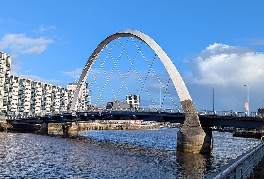

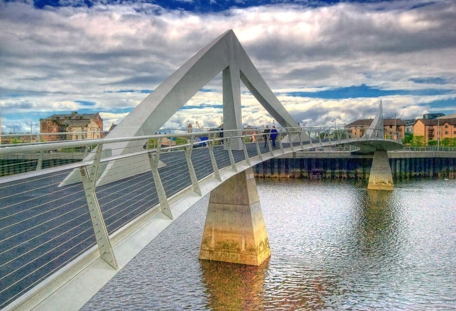

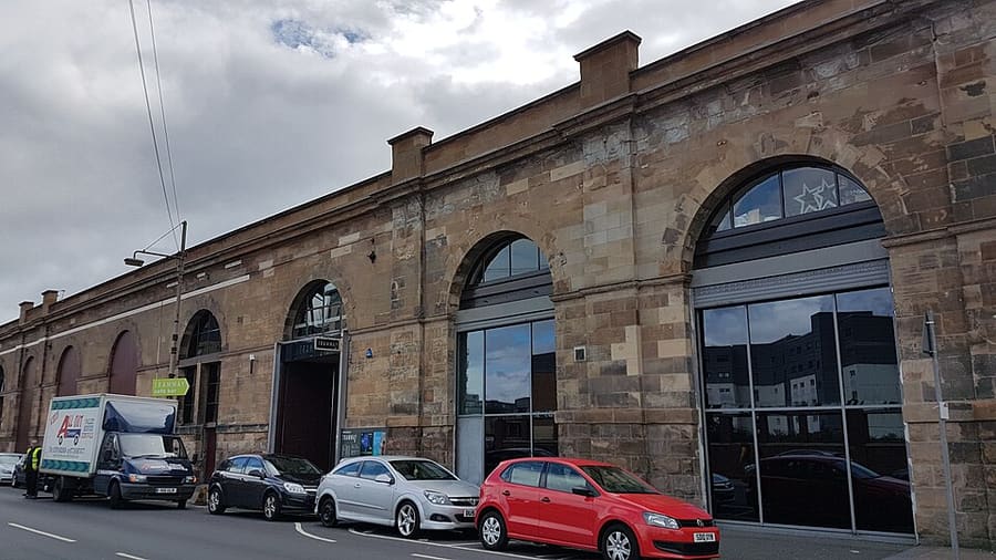

Stations, bridges and harbours from our guide where we hold a photo; each links to the area page that lists it.
Paying for local transport in Glasgow
SPT (Subway, ZoneCard) and bus operators
- SPT runs the Glasgow Subway. It lists Subway tickets by contactless, smartcard and paper, a ZoneCard offering "unlimited* travel", day tickets, and concession tickets. No prices are stated on the page.Source: Strathclyde Partnership for Transport (opens in new tab).
ScotRail (Scotland’s trains).ScotRail runs most trains within Scotland. Its tickets page refused automated access, so check ticket types and any Scotland-only offers on its site.ScotRail tickets (opens in new tab)
Without a car
Getting here
By train
Visit Glasgow says Glasgow Central links the city to the south of the UK, while Queen Street runs mainly to Edinburgh and the north. Avanti West Coast's route page gives the journey from London Euston to Glasgow Central as around five hours. The Caledonian Sleeper offers an overnight train from London. Visit Glasgow also lists direct trains between Manchester Airport and Glasgow Central, with an average journey of 3 hours 45 minutes. 1
Avanti West Coast: London to Glasgow (opens in new tab) · Caledonian Sleeper (opens in new tab) · TransPennine Express (opens in new tab) · National Rail (opens in new tab)
By air
Visit Glasgow calls Glasgow Airport the closest airport to the centre, with an electric express bus from outside the terminal reaching the city in around 15 minutes. First Bus says the Glasgow Airport Express runs 24 hours a day from Stand 1 at the airport to Stand 46 at Buchanan Bus Station, with stops across the city centre. Visit Glasgow also lists Glasgow Prestwick, 32 miles away, and Edinburgh Airport, 39 miles away, from where a direct bus to Buchanan Bus Station takes around an hour. 2
First Bus: Greater Glasgow (opens in new tab) · Glasgow Prestwick Airport (opens in new tab) · Edinburgh Airport (opens in new tab) · Visit Glasgow: getting here (opens in new tab)
By coach
Buchanan Bus Station is in the city centre, close to Buchanan Street Subway station, according to SPT. Citylink's site blocked automated requests, so check it and National Express for routes and times. 3
Once you are there
Subway, trains and buses
Visit Glasgow says the Subway has 15 stations and a full loop takes about 24 minutes, that Glasgow Central and Queen Street stations are about a 12-minute walk apart, and that First Bus runs over 80 routes. Taxis can be hailed when the yellow light is on. 4
Walk the centre
Visit Glasgow calls Glasgow a very walkable city, especially the centre. Glasgow Central and Queen Street stations are within a 12-minute walk of each other.
Ride the Subway
SPT says the Subway takes 24 minutes to complete a circuit of its fifteen stations, with trains every four minutes at peak times. Large prams and pushchairs may need to be folded or refused for lack of space. Check SPT for hours and tickets. 5
Use the trains
Visit Glasgow says a Roundabout ticket gives a day of unlimited travel on ScotRail and Subway services, to more than 110 stations in the Greater Glasgow area. 6
Take a bus
Visit Glasgow says First Bus Glasgow operates over 80 routes across the city, and the First Bus app sells tickets and tracks buses. 2
Cycle or take a taxi
Visit Glasgow lists a cycle hire scheme run by Voi, route ideas from Sustrans, and Glasgow Taxis, which can be hailed when the yellow light is on. 6
Try the open-top bus
Visit Glasgow says City Sightseeing Glasgow runs a red route through the centre and the West End, taking about 90 minutes, with one wheelchair space on the lower deck of each bus. 6
Stops near each area
From our area guides (Glasgow): the stations and stops listed for each base. See each area's Getting there page for more.
West End & Kelvingrove
- Hillhead: Glasgow Subway. SPT lists Byres Road, Ashton Lane, the Botanic Gardens, the university and the Hunterian as nearby
- Kelvinhall: Glasgow Subway. SPT lists Kelvingrove Museum and Kelvin Hall as nearby
- Kelvinbridge: Glasgow Subway. SPT lists Kelvingrove Park as nearby
Merchant City & City Centre
- Glasgow Central: Rail. Principal station for services to the south and west, per Visit Glasgow
- Glasgow Queen Street: Rail. Station for the north and east, including Edinburgh, per Visit Glasgow
- Buchanan Street: Glasgow Subway. SPT lists Queen Street station, Buchanan Bus Station and Buchanan Galleries as nearby
- St Enoch: Glasgow Subway. SPT lists Central Station, St Enoch Centre and Argyle Street as nearby
- Cowcaddens: Glasgow Subway. SPT lists the Glasgow School of Art, GFT and the Tenement House as nearby
Finnieston, Clydeside & the Riverside
- Partick: Glasgow Subway. SPT lists Partick rail and bus stations and the Riverside Museum as nearby
- Cessnock: Glasgow Subway. SPT lists Glasgow Science Centre, the IMAX and the SEC as nearby
- Govan: Glasgow Subway. SPT lists Govan Bus Station, the Queen Elizabeth University Hospital and Govan Old Parish Church as nearby
- Kinning Park: Glasgow Subway. On the south side of the river; SPT lists the Grand Ole Opry as nearby
The Southside
- Shields Road: Glasgow Subway. Next to Scotland Street School Museum, according to SPT
- Bridge Street: Glasgow Subway. SPT lists the Citizens Theatre as nearby
- Ibrox: Glasgow Subway. SPT lists Bellahouston Park as nearby
Cathedral Precinct, Necropolis & Dennistoun
- Glasgow Queen Street: Rail. Terminus for the north and east, per Visit Glasgow; the cathedral is a walk east through the centre
- Buchanan Street: Glasgow Subway. SPT lists Queen Street station and Buchanan Galleries as nearby; allow a walk east to the cathedral
Glasgow Green & the East End
- Glasgow Central: Rail. Principal station for the south and west, per Visit Glasgow; check ScotRail for services east to Celtic Park
- St Enoch: Glasgow Subway. Closest Subway stop to the city centre side of the Green; SPT lists Central Station and Argyle Street as nearby
Partick & Hyndland
- Partick: Glasgow Subway. SPT lists Partick Rail Station, Partick Bus Station and the Riverside Museum as nearby
- Kelvinhall: Glasgow Subway. Next to Kelvin Hall and Kelvingrove, on the eastern edge of this area
- Hyndland: ScotRail. Wikipedia says Hyndland station serves Hyndland on the Argyle and North Clyde Lines; check ScotRail for trains
Shawlands & Langside
- Crossmyloof: ScotRail. Wikipedia says the station serves Crossmyloof and Shawlands on the Glasgow South Western Line; check ScotRail for trains
- Pollokshaws West: ScotRail. Listed in OpenStreetMap near Pollokshaws Burgh Hall and Pollok Country Park; check ScotRail for services
- Langside: ScotRail. Listed in OpenStreetMap on the eastern side of the area; check ScotRail for services
Charing Cross & Garnethill
- Cowcaddens: Glasgow Subway. SPT lists Glasgow School of Art, the Glasgow Film Theatre and the Tenement House as nearby
- Kelvinbridge: Glasgow Subway. SPT lists Kelvingrove Park as nearby; it is the nearest stop for Woodlands and St Mary's Cathedral
- Charing Cross: ScotRail. Station at the Charing Cross junction; check ScotRail for services
- St George's Cross: Glasgow Subway. Listed in OpenStreetMap on Garnethill's northern edge; check SPT for stations and times
No timetables or fares are copied here: check the operator or Traveline for the day you travel. Taxis and ride-hailing apps operate in most towns, but we have no sourced coverage data for rural areas, so do not count on one at short notice.
With a car
By car
Visit Glasgow lists the M8 to Edinburgh, the M80 to Stirling, the M77 to the west coast, and the A1, M6 or M74 from England. It also says Glasgow has a Low Emission Zone in the city centre, where vehicles that do not meet the standards face a penalty charge; check Glasgow City Council for your vehicle. 7
Low Emission Zone
Visit Glasgow says a Low Emission Zone covers the city centre and non-compliant vehicles face a penalty charge. The national standard for cars is petrol Euro 4 or higher and diesel Euro 6 or higher; the online checker does not cover vehicles registered outside the UK. Glasgow City Council's own LEZ page blocked automated access when we checked, so read it in your browser. 4,8,9
Zones to check
| Zone | When | Cars | Amount | Official page |
|---|---|---|---|---|
| Glasgow Low Emission Zone 10,8,4,9 | 24 hours a day, 7 days a week (Scotland's LEZ rules, mygov.scot). Glasgow's own page blocked automated access, so check its start date and boundary on the council site. | Cars must be petrol Euro 4 or higher, or diesel Euro 6 or higher, unless exempt. Visit Glasgow says non-compliant vehicles face a penalty charge. | No daily charge. Penalty amounts: check the council | Official page for Glasgow Low Emission Zone (opens in new tab) |
Amounts as the official page stated on 25 Oct 2026. For vehicles registered outside the UK see the full table on the driving guide.
General rules (driving on the left, licences, roundabouts, speed limits in mph, parking, tolls, EV charging): Driving in Britain. Charge points: Zapmap (opens in new tab).
To and from other regions
Straight-line distance from our region centres, and the fastest train time that National Rail publishes on its destination pages (not a timetable; it may include a change). Where we found no figure we say so. The full table is on getting between regions.
| To or from | Straight line | Fastest train (National Rail) | Notes |
|---|---|---|---|
| Bath | 514 km (319 miles) | No official figure found. Check National Rail (opens in new tab) | — |
| Bristol | 502 km (312 miles) | 6 h 41 min 12 | — |
| Cambridge | 497 km (309 miles) | No official figure found. Check National Rail (opens in new tab) | — |
| Cardiff | 492 km (306 miles) | No official figure found. Check National Rail (opens in new tab) | — |
| Cornwall | 626 km (389 miles) | No official figure found. Check National Rail (opens in new tab) | — |
| Edinburgh | 68 km (42 miles) | 45 min 13 | The Glasgow page lists 46 min. |
| Liverpool | 285 km (177 miles) | 2 h 23 min 14 | — |
| London | 555 km (345 miles) | 4 h 20 min 12 | — |
| Manchester | 295 km (183 miles) | 3 h 11 min 12 | — |
| Northern Ireland | 207 km (129 miles) | No official figure found. Check National Rail (opens in new tab) | The 2 hours 15 minutes is the Stena Line crossing between Belfast and Cairnryan only (about 12 daily sailings, per Stena). Stena says Glasgow is "less than 2 hours away by car, rail or bus" from Cairnryan. |
| Oxford | 498 km (309 miles) | No official figure found. Check National Rail (opens in new tab) | — |
| Portsmouth and Southampton | 592 km (368 miles) | No official figure found. Check National Rail (opens in new tab) | — |
| Stratford & Warwickshire | 437 km (271 miles) | No official figure found. Check National Rail (opens in new tab) | — |
| The Cotswolds | 470 km (292 miles) | No official figure found. Check National Rail (opens in new tab) | — |
| The Jurassic Coast | 589 km (366 miles) | No official figure found. Check National Rail (opens in new tab) | — |
| The Lake District | 173 km (108 miles) | No official figure found. Check National Rail (opens in new tab) | — |
| The Peak District | 332 km (206 miles) | No official figure found. Check National Rail (opens in new tab) | — |
| The Scottish Highlands | 154 km (96 miles) | No official figure found. Check National Rail (opens in new tab) | — |
| Wales | 397 km (247 miles) | No official figure found. Check National Rail (opens in new tab) | — |
| York | 293 km (182 miles) | No official figure found. Check National Rail (opens in new tab) | — |
Figures retrieved 25 Oct 2026 for the intercity data. Timetables change.
Stations in our data
54 stations and stops (Glasgow)
OpenStreetMap contributors (ODbL), via Nominatim search (may be incomplete); Glasgow Subway stations from Wikipedia coordinates, station list from SPT. Fetched 2026-10-25. This is the list behind the near-me page, not a complete list of stations.
- Alexandra Parade (station)
- Anderston (station)
- Argyle Street (station)
- Barnhill (station)
- Bellgrove (station)
- Bridge Street (Subway) (metro)
- Bridgeton (station)
- Buchanan Street (Subway) (metro)
- Burnside (station)
- Cambuslang (station)
- Carmyle (station)
- Carntyne (station)
- Cessnock (Subway) (metro)
- Charing Cross (Glasgow) (station)
- Cowcaddens (Subway) (metro)
- Crossmyloof (station)
- Dumbreck (station)
- Exhibition Centre (station)
- Gilshochill (station)
- Glasgow Central (station)
- Glasgow Queen Street (station)
- Govan (Subway) (metro)
- High Street (station)
- Hillhead (Subway) (metro)
- Hillington East (station)
- Hyndland (station)
- Ibrox (Subway) (metro)
- Jordanhill (station)
- Kelvinbridge (Subway) (metro)
- Kelvindale (station)
- Kelvinhall (Subway) (metro)
- Kennishead (station)
- Kings Park (station)
- Kinning Park (Subway) (metro)
- Langside (station)
- Maryhill (station)
- Muirend (station)
- Partick (Rail) (station)
- Partick (Subway) (metro)
- Patterton (station)
- Pollokshaws East (station)
- Pollokshaws West (station)
- Possilpark and Parkhouse (station)
- Queens Park (station)
- Robroyston (station)
- Shettleston (station)
- Shields Road (Subway) (metro)
- St Enoch (Subway) (metro)
- St George's Cross (Subway) (metro)
- Summerston (station)
- Thornliebank (station)
- West Street (Subway) (metro)
- Whitecraigs (station)
- Williamwood (station)
Official links
- Visit Glasgow (opens in new tab): the city's official visitor site
- Visit Glasgow: getting here (opens in new tab): train, air, road and sea
- Visit Glasgow: getting around (opens in new tab): Subway, buses, bikes and taxis
- Visit Glasgow: accessibility (opens in new tab): planning an accessible visit
- SPT: Glasgow Subway (opens in new tab): maps, stations and tickets
- SPT: Subway timetables (opens in new tab): operating times and frequency
- First Bus: Greater Glasgow (opens in new tab): city buses and the airport express
- Avanti West Coast (opens in new tab): trains from London and the north west
- Caledonian Sleeper (opens in new tab): overnight trains from London
- ScotRail (opens in new tab): most Scottish services (the site blocks automated checks)
- Glasgow Airport (opens in new tab): flights and onward transport (the site blocks automated checks)
- National Rail Enquiries (opens in new tab): train times and fares
- Glasgow Life (opens in new tab): museums, libraries and venues
More on Glasgow: Glasgow guide · how to get there
Questions people ask
Can I get around Glasgow without a car?
Glasgow can be done without a car: the centre is walkable and the Subway, trains and buses cover the sights. The city centre is a Low Emission Zone, so check a hire car before driving in.
Do I need to check a driving zone in Glasgow?
Yes: Glasgow Low Emission Zone applies. The table on this page links the official pages.