 English (UK)
 English (US)
 Français
 Deutsch
 Español
 Italiano
 Nederlands
 简体中文
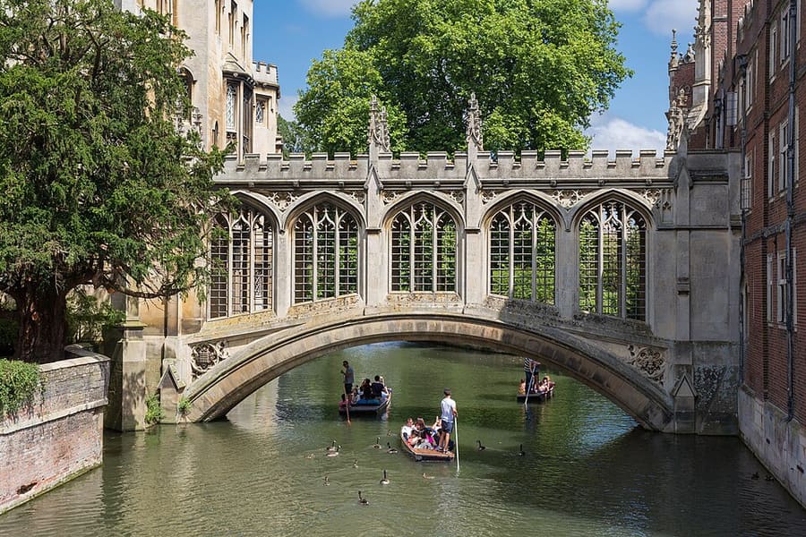
Una mini guida a
Colleges and the Backs: come arrivare
Fermate, stazioni e come raggiungere Colleges and the Backs
Fermate e stazioni
Come arrivare a Colleges and the Backs
Scegliere la fermata più vicina alla destinazione.
| Fermata o stazione | Servizi | Adatto a |
|---|---|---|
| Stazione di Cambridge | Great Northern, Greater Anglia, CrossCountry e altri gestori | A circa un miglio a sud-est del centro città; si prosegue a piedi, in autobus o in taxi |
| Park & Ride | Babraham Road, Madingley, Milton Road, Newmarket Road e Trumpington | Stagecoach East collega con autobus le cinque aree di sosta al centro città |
| A piedi | Da Market Square | I Backs e le facciate dei college sono a pochi passi dal centro |
Within walking range
Stations near Colleges and the Backs
Stations and stops mapped in OpenStreetMap within 2.5 km of the centre of Colleges and the Backs, nearest first. Distances are straight lines; walking times assume 5 km/h and are a minimum.
| Station or stop | Tipo | Distanza | A piedi |
|---|---|---|---|
| Drummer Street Bus Station | Bus or coach station (Cambridgeshire County Council) | 700 m | about 8 min |
| Parkside bus stops | Bus or coach station | 1.1 km | about 13 min |
| Grafton Centre Bus Station | Bus or coach station | 1.4 km | about 16 min |
| Beehive Centre bus station | Bus or coach station | 2.0 km | about 24 min |
| Cambridge | Rail station (Greater Anglia) | 2.2 km | about 26 min |
| Madingley Road Park & Ride | Bus or coach station | 2.3 km | about 27 min |
Station data: © OpenStreetMap contributors (ODbL), read 1 November 2026. Check step-free access with the operator before you travel.
Walking from nearby areas
- King's Parade and Market Square: 500 m from Colleges and the Backs, about 6 min on foot
- Museums, Botanic Garden and the South: 1.2 km from Colleges and the Backs, about 15 min on foot
- Mill Road and the East: 1.5 km from Colleges and the Backs, about 18 min on foot
Raggiungere Cambridge
Informazioni ufficiali sui trasporti
Cambridge ha una stazione ferroviaria a circa un miglio a sud-est del centro, e l'aeroporto di Stansted è collegato da un treno diretto. Verificare sempre con i gestori orari, tariffe e disservizi aggiornati.
- Visit Cambridge: arrivare a Cambridge → — treni, Park & Ride e parcheggi
- Visit Cambridge: arrivare a Cambridge in auto → — strade e parcheggi
- National Rail: Cambridge → — informazioni sulla stazione e pianificazione del viaggio
- Great Northern: treni per Cambridge → — pagina del gestore
- Thameslink: treni per Cambridge → — pagina del gestore
- Stagecoach East: Park & Ride di Cambridge → — aree di sosta e autobus
- Cambridge City Council: parcheggi → — tariffe dei parcheggi
- Greater Cambridge Partnership → — progetti per i trasporti nella zona
Orari, tariffe e disservizi cambiano: per informazioni in tempo reale consultare le pagine dei gestori qui sopra.
Pianifichi qui il tragitto
Inserisca il punto di partenza e Google Maps mostrerà i percorsi per Colleges and the Backs. Il trasporto pubblico è preselezionato; si può cambiare sulla mappa. Per eventuali disagi in tempo reale, controllare i siti degli operatori.
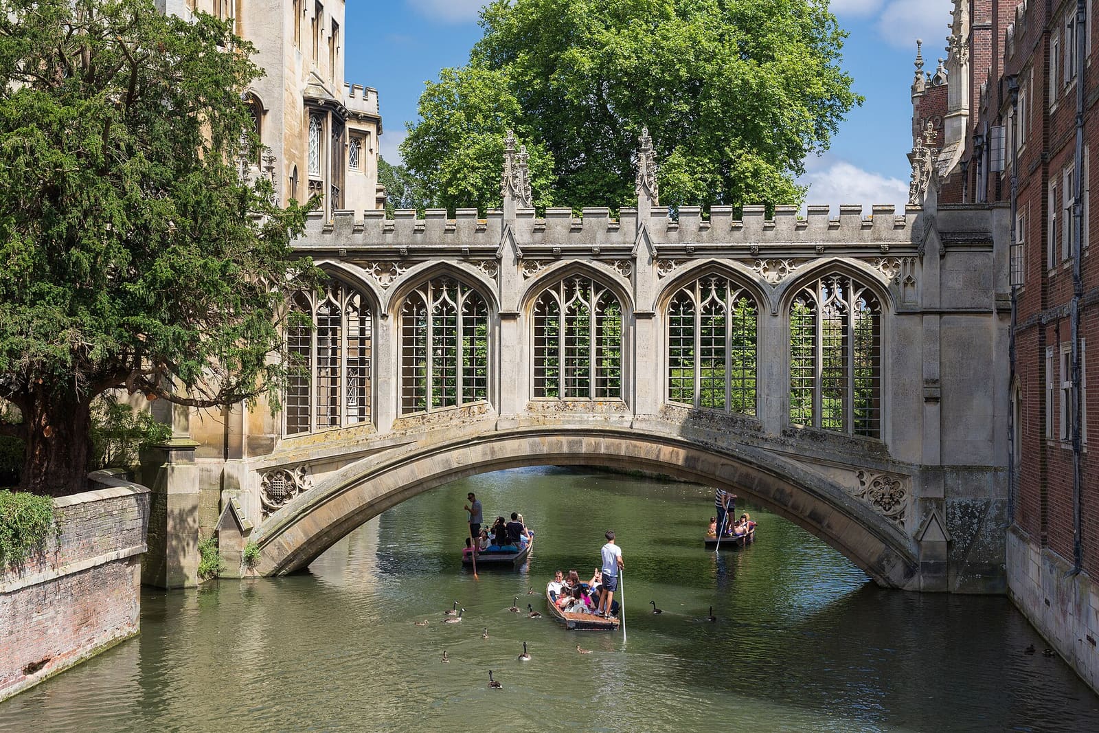
While you are here
Things to see in Colleges and the Backs
A few of the sights in the area. The Things to do page lists them all, with directions and official links.
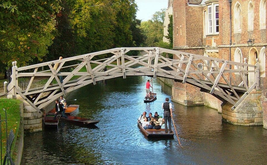
Mathematical Bridge
Passerella in legno sul Cam che collega due parti del Queens' College; il suo nome ufficiale è Wooden Bridge.
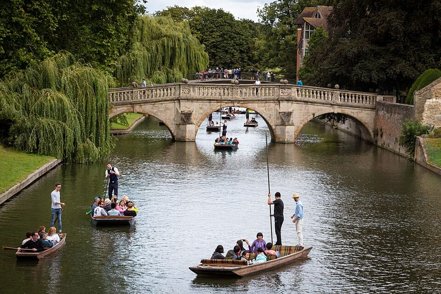
Clare Bridge
Ponte tutelato come Grade I sul Cam che collega Clare's Old Court a Memorial Court.
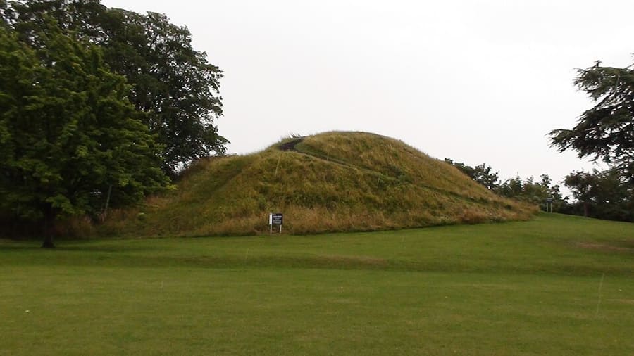
Castle Mound
Terrapieno del Cambridge Castle, costruito dopo il 1066 per controllare la strada verso nord uscendo dalla città.
Cambridge
More areas to explore
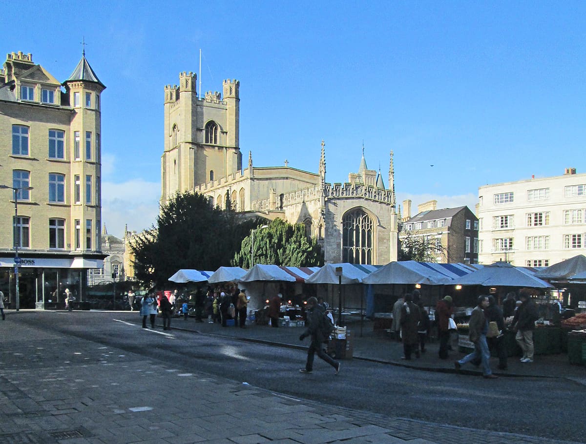
King's Parade and Market Square
King's Parade, Market Square e Trinity Street nel cuore storico della città
Apri la mini guida →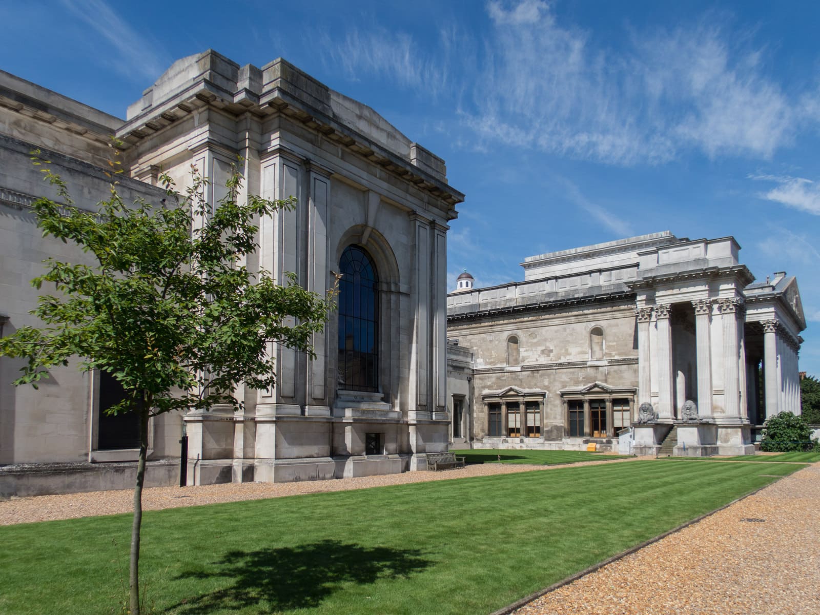
Museums, Botanic Garden and the South
Il Fitzwilliam, i musei di Downing Street, l'orto botanico e i prati verso Grantchester
Apri la mini guida →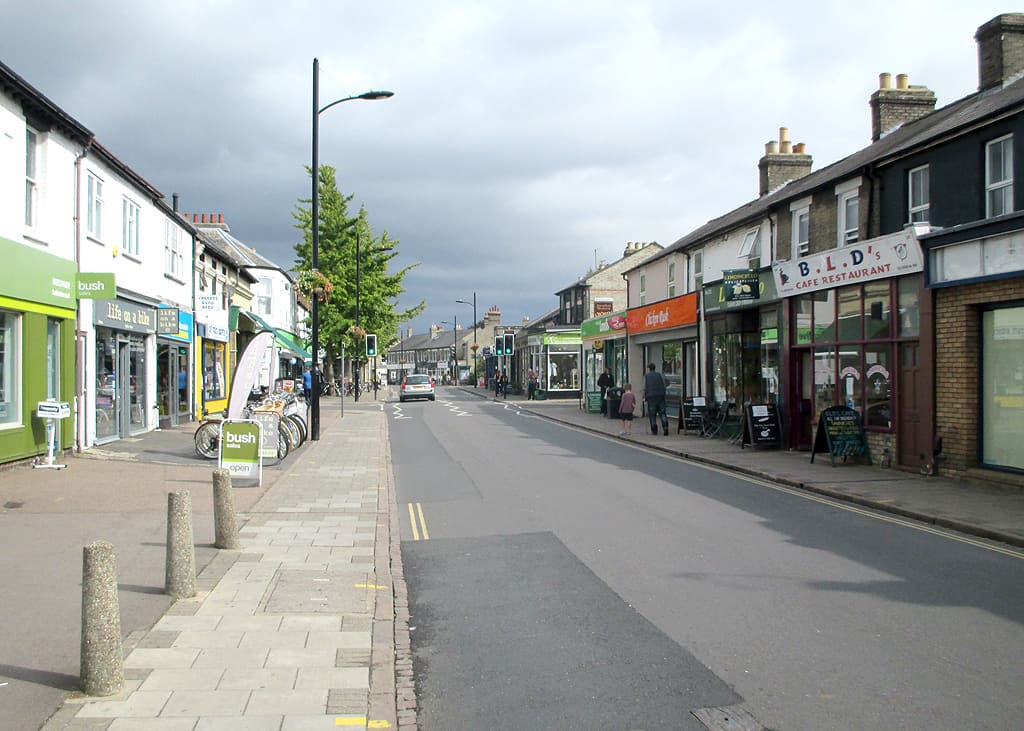
Mill Road and the East
Negozi e ristoranti indipendenti su Mill Road, con i prati comuni e il fiume a nord-est
Apri la mini guida →Crediti fotografici
- Bridge of Sighs: Diliff, CC BY-SA 3.0, source
- Colleges and the Backs (area photo): Diliff, CC BY-SA 3.0, source
- Mathematical Bridge: Steff, CC BY-SA 3.0, source
- Clare Bridge: Rafa Esteve, CC BY-SA 4.0, source
- Castle Mound: Myself., CC BY 3.0, source
- King's Parade and Market Square: John Sutton, CC BY-SA 2.0, source
- Museums, Botanic Garden and the South: Kim Fyson, CC BY-SA 2.0, source
- Mill Road and the East: John Sutton, CC BY-SA 2.0, source
Photos from Wikimedia Commons, used under the licences shown. All photo credits
Continua a esplorare Cambridge