 English (UK)
 English (US)
 Français
 Deutsch
 Español
 Italiano
 Nederlands
 简体中文
Wales · Linear (one way)
Pembrokeshire Coast Path: Porthgain to Whitesands
A rugged cliff-top section of the National Trail from a harbour village to St Davids Head's beach.
- Distance 16.1 km · 10.0 miles As stated on the official page
- Typical time Not stated The official page gives no time, so we show none.
- Ascent Not stated No official ascent figure
- Grade Hard Our rule, see below
- Route typeLinear (one way) Porthgain to Whitesands Bay (Porth Mawr)
Take this walk offline
Near the start, along the way and at the finish


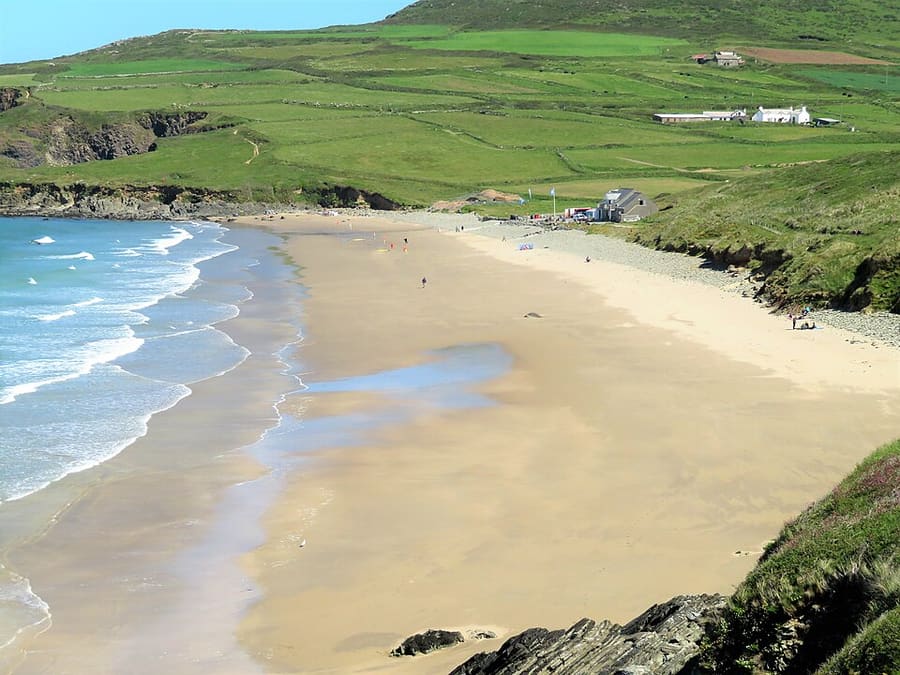



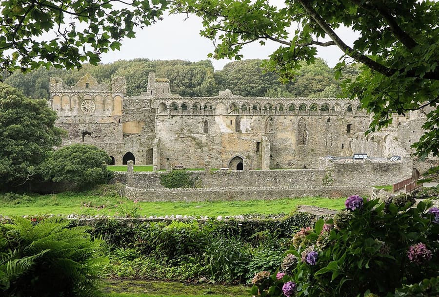

Photos of named places from our guides closest to each point of the walk, with the straight-line distance. They show the area, not the path itself: follow the waymarks and the official page.
The route
This is section 5 of the Pembrokeshire Coast Path as the National Trails site splits it. It runs along cliffs from Porthgain harbour to Whitesands Bay, a remote stretch where the trail site says it is rugged in places. It is a one-way walk, so plan how you will get back.
The interactive map needs JavaScript. The start and finish are listed below.
Along the way
- Start: Porthgain
- Finish: Whitesands Bay (Porth Mawr)
The line is drawn from OpenStreetMap data and simplified to 453 points. It can differ from what is on the ground: waymarks and the official page take priority.
Route and map data © OpenStreetMap contributors (ODbL), saved 2026-10-25. Spotted a mistake? Fix the map.
The GPX file holds the route as a track and the start, finish and waypoints, for use in a walking or hiking app. It is a planning aid, not a navigation guarantee.
Before you go
Safety and access notes come from official pages. Conditions change, so read the linked page for the day you walk.
Getting there
- Nearest station or stop to the start in our dataFishguard and Goodwick (rail, Transport for Wales Rail), about 14.2 km in a straight line.
- Nearest to the finishFishguard and Goodwick (rail, Transport for Wales Rail), about 23.8 km in a straight line.
Straight-line distances from our station list, not walking distances. Check timetables and the route to the start before you travel. Getting between regions
Step-free and pushchair access
The official page does not say whether this route is step-free or suitable for pushchairs, so we do not either. Check the official page (opens in new tab) or ask the site.
Safety
- The Coast Path Safety Code asks walkers to stay on the path, away from cliff edges and overhangs, to supervise children closely near cliffs, and not to take beach shortcuts where the tide can cut you off. It adds that cliff-top walking is risky in high winds. Pembrokeshire Coast National Park: Coast Path Safety Code (opens in new tab)
- The trail site says this section is remote and refreshments are at the Whitesands cafe, and at a refreshment van at Abereiddi if walking south to north. It also says phone signal is unreliable or absent along much of the coast, so do not rely on a phone for navigation. National Trails: Pembrokeshire Coast Path route description (opens in new tab)
- The trail overview page suggests telling someone your plans, and carrying a map or guidebook, waterproofs, warm layers and water. National Trails: Pembrokeshire Coast Path information (opens in new tab)
Seasonal access
- The route description says coastal erosion means the path in this stretch is regularly reviewed for safety. The park authority's trail news page listed no diversion between Porthgain and Whitesands when checked, so check it again before you go. Pembrokeshire Coast National Park: Trail news (opens in new tab)
How these figures were worked out
- Distance: taken from the official page (source (opens in new tab)).
- Grade: our rule, because the official page gives no grade. Easy: up to 8 km and up to 150 m of ascent. Hard: over 16 km or over 600 m of ascent. Moderate: everything else. No ascent figure is available for this walk, so the rule used distance only and the real grade may be higher.
- The line on the map measures about 14.9 km from OpenStreetMap geometry, which differs from the official figure because the start and finish points of the drawn line are approximate and the data is simplified. Use the official figure and the waymarks.
- Time: only shown when an official page states it.
Sources
- National Trails: Pembrokeshire Coast Path route description (opens in new tab). section 5 Porthgain to Whitesands: 10 miles (16.1 km), rugged in places, remote, refreshments, erosion review. Checked on 2026-10-25.
- National Trails: Pembrokeshire Coast Path information (opens in new tab). trail overview, phone signal, kit and tell-someone advice. Checked on 2026-10-25.
- Pembrokeshire Coast National Park: Coast Path Safety Code (opens in new tab). cliff, weather, tide and kit advice. Checked on 2026-10-25.
- Pembrokeshire Coast National Park: Trail news (opens in new tab). no diversion listed for this stretch when checked. Checked on 2026-10-25.
- OpenStreetMap relation 20279882 (Pembrokeshire Coast Path main route), clipped (opens in new tab). route geometry (c) OpenStreetMap contributors, ODbL; clipped line measures 14.9 km against the official 16.1 km. Checked on 2026-10-25.
- OpenStreetMap contributors (opens in new tab) (ODbL). Route geometry. Saved 2026-10-25.
More walks in Wales
Beacons Way: Storey Arms to Craig-y-Nos
Day 5 of the Beacons Way: a long moorland ridge walk west from the A470 to Craig-y-nos Country Park.
Pyg Track to Yr Wyddfa (Snowdon)
A rocky, steep mountain path from Pen-y-Pass to the summit, graded hard by the park authority.
Llanberis Path to Yr Wyddfa (Snowdon)
The longest and gentlest-graded route up Snowdon, from Llanberis, still graded hard by the park authority.