 English (UK)
 English (US)
 Français
 Deutsch
 Español
 Italiano
 Nederlands
 简体中文
Not yet assessed Onze lezing van de onderstaande bronnen, geen officiële beoordeling.
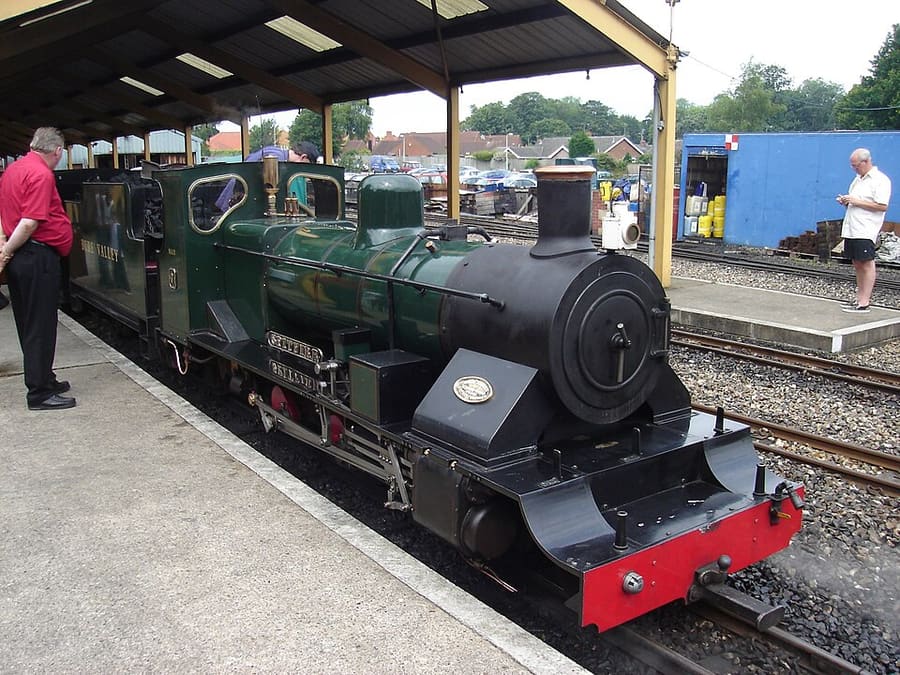

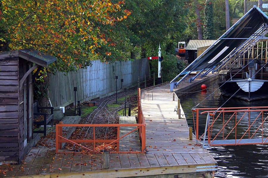

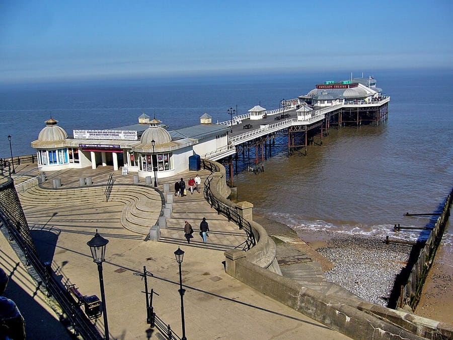

Stations, bridges and harbours from our guide where we hold a photo; each links to the area page that lists it.
Zonder auto
Hoe kom je er
Met de trein
Greater Anglia runs inter-city trains between London Liverpool Street and Norwich, and Visit Norfolk says the county can be reached by rail from London in as little as 90 minutes. From Norwich, the Bittern Line runs to Hoveton & Wroxham, Cromer, West Runton and Sheringham, typically once an hour. Great Northern runs from London King's Cross to King's Lynn via Cambridge and Ely; Wikipedia gives a typical journey time of 1 hour 45 minutes. 1
National Rail: Norwich station (opens in new tab) · National Rail: King's Lynn station (opens in new tab) · Cambridge guide (opens in new tab)
By bus along the coast
Lynx runs the Coastliner 36 from King's Lynn via Hunstanton to Wells-next-the-Sea and Fakenham. Sanders Coaches runs the Coasthopper buses along the north Norfolk coast from Wells towards Cromer. 2
Lynx buses (opens in new tab) · Sanders Coaches: Coasthopper (opens in new tab)
Met het vliegtuig
Norwich Airport has scheduled KLM flights to and from Amsterdam Schiphol on its departures board. Check the airport's site for current routes. 3
Als u er eenmaal bent
Use the Bittern Line
Trains from Norwich stop at Salhouse, Hoveton & Wroxham, North Walsham, Cromer, West Runton and Sheringham, so the Broads and the coast work as day trips from the city. 1
Coastal buses
The Coastliner 36 (Lynx) and the Coasthopper (Sanders Coaches) meet at Wells-next-the-Sea and link the towns and villages along the north coast. 4
Stoomtreinen en museumspoorlijnen
The Bure Valley Railway runs between Wroxham and Aylsham, the North Norfolk Railway between Sheringham and Holt, and the Wells and Walsingham Light Railway from Wells to Walsingham. 5
On the water
Wroxham and Hoveton have boatyards and hire firms on the River Bure; Wroxham Bridge is low and a pilot service on the Hoveton side helps boaters for a fee. 6
Langs de kust wandelen
The Norfolk Coast Path, a National Trail, runs from Hunstanton along the north coast through Wells, Blakeney, Sheringham and Cromer.
Haltes bij elk gebied
From our area guides (Norfolk and the Broads): the stations and stops listed for each base. See each area's Getting there page for more.
Norwich
- Norwich station: Greater Anglia, East Midlands Railway. Inter-city trains to London Liverpool Street, plus services to Cambridge and Stansted Airport, Liverpool Lime Street, Sheringham, Great Yarmouth and Lowestoft. National Rail lists step-free access to all platforms.
- Norwich Airport: KLM and others. Scheduled flights to Amsterdam Schiphol appear on the airport's departures board; check the airport site for current routes.
Wroxham, Hoveton & the northern Broads
- Hoveton & Wroxham station: Greater Anglia (Bittern Line). About 8.75 miles from Norwich on the line to Cromer and Sheringham, with a typical service of one train an hour each way.
- Bure Valley Railway (Wroxham): Bure Valley Railway. Narrow-gauge steam railway between Wroxham and Aylsham; check its timetable before you travel.
- River Bure: Boat hire and trips. Wroxham Bridge is one of the hardest bridges on the Broads to navigate, and a pilot station on the Hoveton side helps boaters for a fee.
Cromer & Sheringham
- Cromer, West Runton and Sheringham stations: Greater Anglia (Bittern Line). The Bittern Line runs from Norwich to Sheringham, with a typical service of one train an hour each way.
- North Norfolk Railway: Heritage railway. The Poppy Line runs about five miles from Sheringham to Holt.
- Coasthopper buses: Sanders Coaches. Coasthopper buses link Cromer with the coast west towards Wells-next-the-Sea.
Wells, Holkham & Blakeney
- Coastliner 36: Lynx. Bus from King's Lynn via Hunstanton to Wells-next-the-Sea and on to Fakenham.
- Coasthopper: Sanders Coaches. Bus along the coast from Wells-next-the-Sea towards Blakeney and Cromer.
- Wells and Walsingham Light Railway: Heritage railway. Small-gauge line running four miles from Wells to Walsingham.
- Nearest stations: Greater Anglia (Bittern Line). Wells has no railway station; Sheringham, on the Bittern Line from Norwich, is the nearest.
King's Lynn & Sandringham
- King's Lynn station: Great Northern. Trains from London King's Cross via Cambridge and Ely on the Fen Line; Wikipedia gives a typical journey time of 1 hour 45 minutes.
- Coastliner 36: Lynx. Bus from King's Lynn to Hunstanton, Wells-next-the-Sea and Fakenham.
- Lynx local buses: Lynx. Lynx runs other routes from King's Lynn across west Norfolk; see its timetables.
Hier worden geen dienstregelingen of tarieven gekopieerd: controleer de vervoerder of Traveline voor de dag waarop u reist. Taxi's en ritdiensten-apps zijn in de meeste steden beschikbaar, maar we hebben geen gebrongegevens over de dekking op het platteland, dus reken er niet op dat u er op korte termijn een vindt.
Met de auto
We hold no sourced driving notes for Norfolk and the Broads beyond the general rules.
Algemene regels (links rijden, rijbewijzen, rotondes, snelheidslimieten in mph, parkeren, tol, elektrisch laden): Rijden in Groot-Brittannië. Laadpunten: Zapmap (opent in nieuw tabblad).
Van en naar andere regio's
Hemelsbrede afstand vanaf onze regiocentra, en de snelste treintijd die National Rail op zijn bestemmingspagina's publiceert (geen dienstregeling; er kan een overstap bij zitten). Waar we geen cijfer vonden, zeggen we dat. De volledige tabel staat bij reizen tussen regio's.
| Van of naar | Hemelsbreed | Snelste trein (National Rail) | Notes |
|---|
Cijfers opgehaald op 25 okt 2026 voor de gegevens over intercityverbindingen. Dienstregelingen veranderen.
Stations in onze gegevens
40 stations and stops (Norfolk and the Broads)
OpenStreetMap contributors (ODbL), via Overpass API. Fetched 2026-11-03. This is the list behind the near-me page, not a complete list of stations.
- Aylsham (station)
- Brampton (heritage), Bure Valley Railway
- Brundall (rail), Greater Anglia
- Brundall Gardens (rail), Greater Anglia
- Buckenham (rail), Greater Anglia
- Buxton (station)
- Coltishall (station)
- Cromer (rail), Greater Anglia
- Cromer Travel Hub (bus)
- Dereham (rail), Mid-Norfolk Railway
- Downham Market (rail), Govia Thameslink Railway (Great Northern)
- Gunton (rail), Greater Anglia
- Hardingham (station)
- Holt (station)
- Hoveton and Wroxham (rail), Greater Anglia
- Hunstanton (bus)
- Kelling Heath Park (station)
- Kimberley Park (station)
- King's Lynn (rail), Govia Thameslink Railway (Great Northern)
- King's Lynn Bus Station (bus)
- Lingwood (rail), Greater Anglia
- North Walsham (rail), Greater Anglia
- Norwich (rail), Greater Anglia
- Norwich Bus Station (bus)
- Roughton Road (rail), Greater Anglia
- Salhouse (rail), Greater Anglia
- Sheringham (rail), Greater Anglia
- Sheringham (NNR) (rail), North Norfolk Railway
- The Midden (station)
- Thuxton (rail), Mid-Norfolk Railway
- Walsingham (station)
- Warham (station)
- Watlington (rail), Govia Thameslink Railway (Great Northern)
- Wells-on-Sea (station)
- West Runton (rail), Greater Anglia
- Weybourne (station)
- Wighton Halt (station)
- Worstead (rail), Greater Anglia
- Wroxham BVR (station)
- Yaxham (station)
Officiële links
- National Rail: Norwich (opens in new tab): station facilities and step-free access
- National Rail: Hoveton & Wroxham (opens in new tab): the Broads station on the Bittern Line
- National Rail: Cromer (opens in new tab): Bittern Line
- National Rail: Sheringham (opens in new tab): end of the Bittern Line
- National Rail: King's Lynn (opens in new tab): Great Northern trains from London King's Cross
- Visit Norfolk: plan your stay (opens in new tab): the county tourist board
- Visit the Broads (opens in new tab): the Broads National Park visitor site
More on Norfolk and the Broads: Norfolk and the Broads guide · how to get there
Veelgestelde vragen
Can I get around Norfolk and the Broads without a car?
We have not yet assessed getting around Norfolk and the Broads. The official links below, and the region guide, are the place to start.
Do I need to check a driving zone in Norfolk and the Broads?
We found no charging or low emission zone for Norfolk and the Broads in the official pages we read. Check the council site before you drive in.